What is GIS?

I am a GIS enthusiast. Mostly what I do is make maps, create and manage GIS softwares and I Iove R and am learning to appreciate Python. So mainly am a learner in GIS and programming and I like to explore integration of various programming algorithms with GIS.
So what is Geospatial Information Systems or rather just GIS?
The best explanation I have found is from Esri
"GIS is The Science of Where"
I know this really seems more ambiguous than the question itself, but I find this quite concise.
Let me explain why. A field of study is defined as a science if it follows a specified methodology to achieve results. GIS involves precise methods of collecting information about a place and representing this information mainly in form of maps.
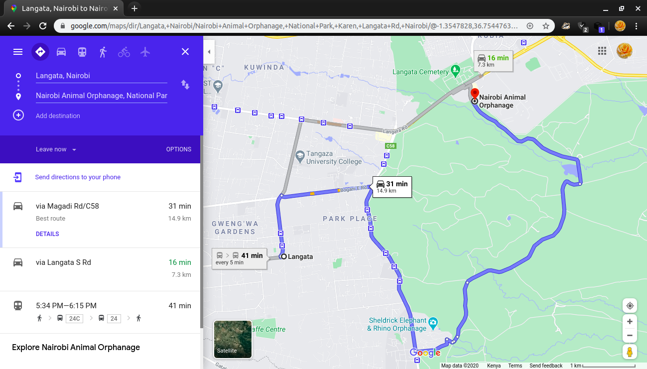
So is this important? Of course, let's say you are lost and would like to know how to get to a place, in this information age, the first thing you would do, is look it up on Google maps and try to figure out how to get to your destination. Well, all these is GIS!
The data on the map was collected, analyzed then presented in form of a map then in addition to that, the information can help you decide the shortest route to take or the route with the least traffic. Isn't this just amazing? I know it looks like it is just a norm but there is so much that just goes on "behind the scenes", and all these can be summarized as GIS.
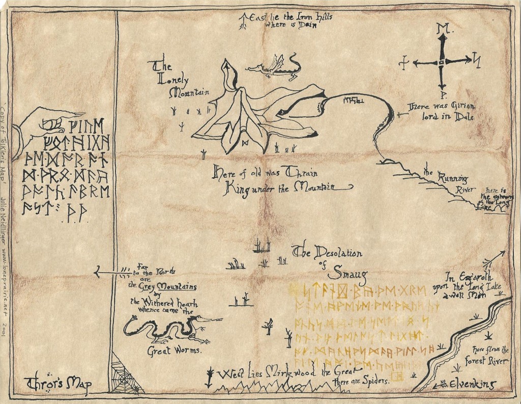
So maybe you're asking how did our forefathers use GIS? Well, it's all in the history, kingdoms were ruled, conquered using maps ( hard copy ones). They used maps( maybe they looked like sketches) but still they used these to draw plans to determine the routes to follow to conquer an enemy or even maybe to get to a certain place. Like Thror's map below from the The Hobbit
So what does the present GIS look like?
Well, it involves tools, software, algorithms, frameworks for gathering, managing, and analyzing data into visualizations using maps and 3D scenes. With this unique capability, GIS reveals deeper insights into data, such as patterns, relationships, and situations—helping users make smarter decisions.
So that in the end, with just a click, you can get an analysis that shows you for instance the least cost path to your destination, considering the shortest distance and presence of traffic. Or the best place to put up your business. Or the region most affected by Covid-19.
GIS is just everywhere, and for it, the sky is not the limit.
What about the future of GIS? Well, it needs to be more integrated in our way of life, the tools to be more utilized by not only by GIS experts but anyone. Maybe one can say we are already doing this; yes, but it is done unknowingly. GIS will be efficiently utilized if the users have an awareness of its capabilities.
So let's take this journey together and dive deeper into GIS!


